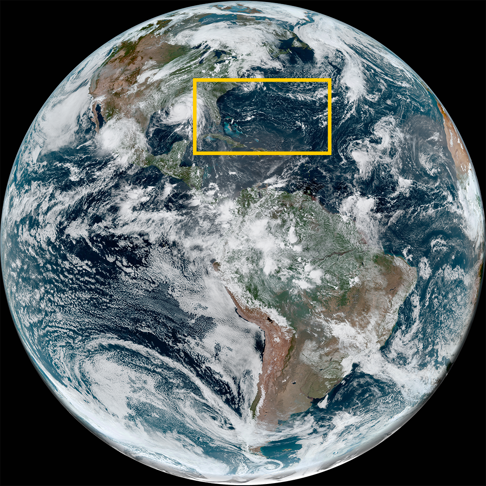
Nicole formed early on November 7th, 2022 as a subtropical storm. Early on November 8th, Nicole transitioned into a tropical storm with maximum sustained winds of 65 mph. A day later, Nicole strengthened into a hurricane with 75 mph winds.
Early on November 10th, Hurricane Nicole made landfall just south of Vero Beach, Florida.
Visit the National Hurricane Center for updated information and forecasts.
Satellite animations of this event:
Hover over the boxes to play. Click the images to view enlarged
Hurricane Nicole's Push into the Eastern U.S.
Description:
Hurricane Nicole’s landfall and northward push into the Eastern U.S.
Satellite: GOES-16
Product: GeoColor
Timespan: 11/10/2022 00:00 - 11/11/2022 17:11 UTC
Hurricane Nicole Landfalls South of Vero Beach, Florida
Description:
Hurricane Nicole makes landfall south of Vero Beach, Florida with winds of 75 mph.
Satellite: GOES-16
Product: GeoColor
Timespan: 11/11/2022 05:58 - 11/11/2022 08:00 UTC
Lightning within Hurricane Nicole as it Approaches Florida
Description:
Lightning within Hurricane Nicole’s northeast quadrant as it approaches Florida’s East Coast.
Satellite: GOES-16
Product: GeoColor, GLM Group Energy Density
Timespan: 11/11/2022 00:29 - 11/11/2022 04:26 UTC
Tropical Storm Nicole Looms off Florida Coast
Description:
A slowly strengthening Tropical Storm Nicole looms off of Florida’s East Coast.
Satellite: GOES-16
Product: GeoColor
Timespan: 11/09/2022 11:01 - 11/09/2022 21:21 UTC
Pulsing Bursts of Convection within Tropical Storm Nicole
Description:
A sunrise to sunset view of Tropical Storm Nicole and the convective bursts within.
Satellite: GOES-16
Product: Visible (band 2), GLM Group Energy Density
Timespan: 11/09/2022 12:30 - 11/09/2022 20:29 UTC
Tropical Storm Nicole Hits the Abaco Islands
Description:
Nicole makes landfall in Great Abaco as a high end tropical storm with maximum sustained winds of 70 mph.
Satellite: GOES-16
Product: Visible (band 2), GLM Group Energy Density
Timespan: 11/09/2022 13:00 - 11/09/2022 16:29 UTC
Tropical Storm Nicole Approaches the Bahamas
Description:
Tropical Storm Nicole slowly strengthens and approaches the Bahamas.
Satellite: GOES-16
Product: GeoColor, GLM Group Energy Density
Timespan: 11/08/2022 22:01 - 11/09/2022 05:51 UTC
Tropical Storm Nicole's Inner Core Begins to Form
Description:
Tropical Storm Nicole gathers strengthen as its inner core develops.
Satellite: GOES-16
Product: Visible (band 2)
Timespan: 11/08/2022 13:28 - 11/08/2022 20:01 UTC
Nicole Becomes a Tropical Storm
Description:
Nicole transitions into a tropical storm as it pushes southwest towards the Bahamas.
Satellite: GOES-16
Product: Visible (band 2)
Timespan: 11/08/2022 12:06 - 11/08/2022 17:01 UTC
High Resolution View of Nicole's Swirls
Description:
A high resolution view of Subtropical Storm Nicole’s low level swirls.
Satellite: GOES-16
Product: Visible (band 2)
Timespan: 11/07/2022 13:00 - 11/07/2022 20:32 UTC
Subtropical Storm Nicole forms North of Caribbean
Description:
Subtropical Storm Nicole forms north of the Caribbean with maximum sustained winds of 45 mph.
Satellite: GOES-16
Product: GeoColor
Timespan: 11/07/2022 11:41 - 11/07/2022 16:06 UTC
98L Pushes North
Satellite: GOES-16
Product: Infrared (band 11)
Timespan: 11/06/2022 07:00 - 11/07/2022 02:40 UTC
98L Organizes North of Caribbean
Satellite: GOES-16
Product: GeoColor, GLM Group Energy Density
Timespan: 11/06/2022 07:00 - 11/07/2022 02:40 UTC