Menu
Home
Events
Archive
Daily
info
x
Hilary was a hurricane located in the Eastern Pacific basin. Hilary brought abundant moisture to Southern California and other parts of the Southwest United States.
Prior to landfall, Hurricane Hilary reached its peak as a category 4 storm. Hilary was also notable for the first ever tropical storm watch issued for Southern California.
Even as Hilary fell apart, it brought significant impacts to the west coast as heavy rainfall and flooding led to the damaging of infrastructure and roadways.
For detailed information and forecasts, visit the National Hurricane Center.
Visit event location on SLIDER
Hover over the boxes to play. Click the images to view enlarged
Description:
Hurricane Hilary’s six-day journey from the Eastern Pacific to the Pacific Northwest.
Satellite: GOES-18
Product: GeoColor
Post-Tropical Cyclone Hilary is bringing some much needed rain to regions of the Northwest where many wildfires are burning.
Smoke is still heavily concentrated from fires in the Northwest and British Columbia outside of the cloud shield.
Tropical Storm Hilary made landfall earlier today.
Tropical storm conditions are expected to continue across the Southwestern US through tonight and Monday.
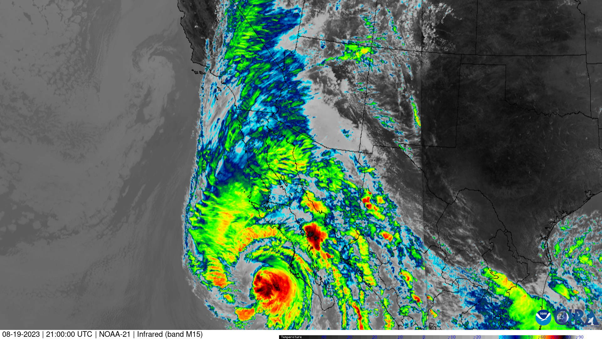
Hurricane Hilary came into view of the US sector on VIIRS polar orbiting satellites during the afternoon flyovers. It’s influence was already felt across the west coast and desert southwest.
Satellite: NOAA-21
Product: Infrared (band m15)
Instrument: VIIRS
Hurricane Hilary approaches the Southwest United States and Baja California Peninsula.
This unique perspective from GOES-16 shows Hurricane Hilary moving north along the North American West Coast.
Satellite: GOES-16
This multi-day evolution shows Hurricane Hilary rapidly intensifying from a tropical storm to a major hurricane.
Product: Infrared (band 13)
Hurricane Hilary is now a category 3 storm. Even with the hurricane weakening, Hilary is forecast to bring a potentially historic amount of rain to the Southwestern US.
Hurricane Hilary continues to move northward while maintaining category 4 strength.
Product: Visible (band 2)
Hilary strengthened overnight to a major, category four hurricane.
Hurricane Hilary intensifies to a major, category three storm with winds of 125 mph.
Hurricane Hilary swirls off the coast of Mexico as smoke covers the central United States.
Rapid intensification reveals Hilary’s central eye as it remains just shy of major hurricane status.
Product: Infrared (band 13) Visible (band 2)
Hilary strengthening from a tropical storm to a hurricane.
Tropical storms Greg, Fernanda, and Hilary lined up in the Eastern Pacific.
Lightning within Tropical Storm Hilary’s outer bands as it begins to organize.
Product: GeoColor GLM Group Energy Density
A disturbance south of Mexico coalesced into Tropical Storm Hilary on the morning of August 16th, 2023.
See more Tropical Cyclones events:
Tropical Storm Harold -