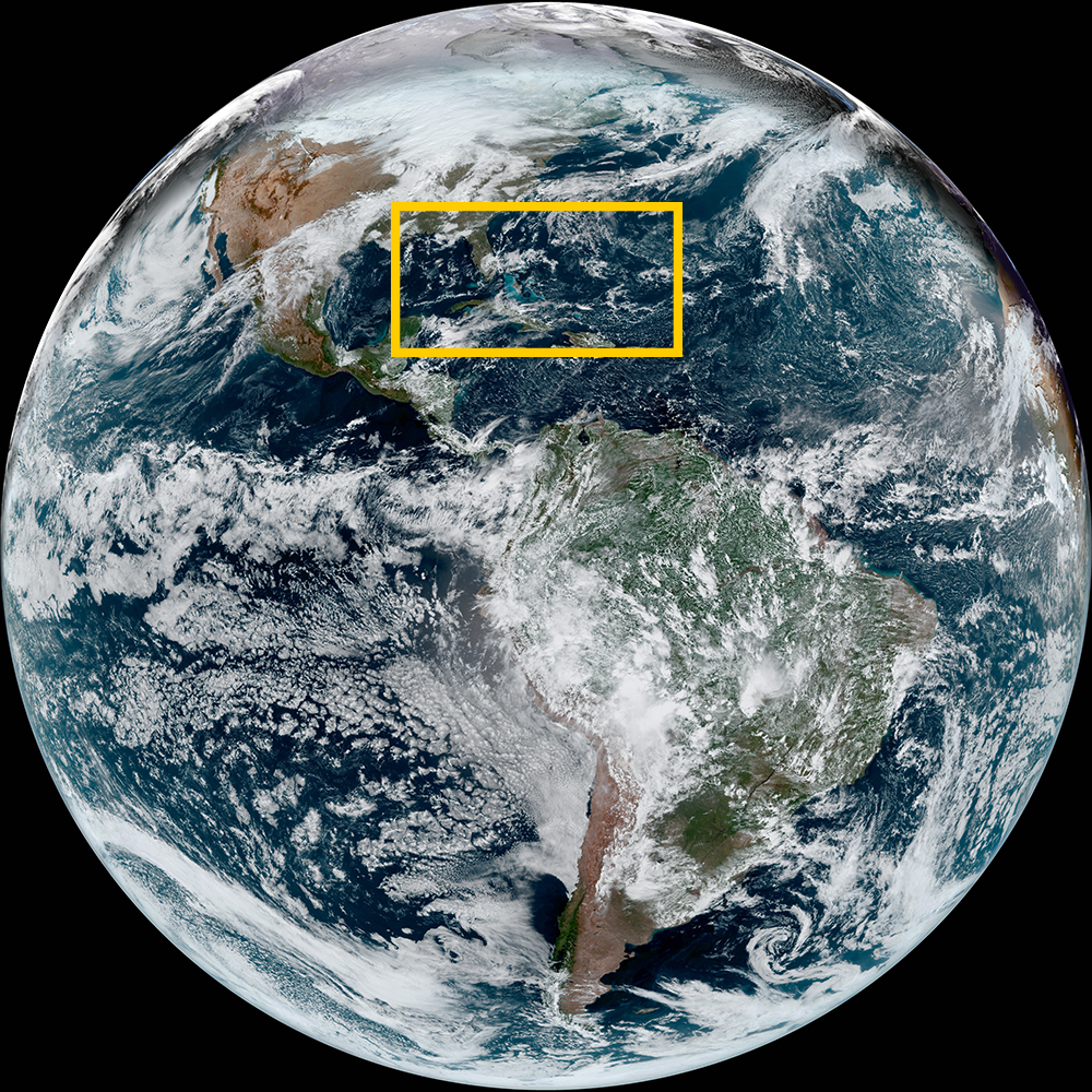
Satellite animations of this event:
Hover over the boxes to play. Click the images to view enlarged
Alex’s Journey from the Yucatan Peninsula to the Open Atlantic
Description:
Alex sluggishly strengthening into a tropical storm and quickly dissipating into a post-tropical low.
Satellite: GOES-16
Product: GeoColor
Timespan: 06/02/2022 00:00 - 06/02/2022 22:40 UTC
Alex Transitions to Post Tropical over Atlantic
Description:
Alex transitions from a tropical storm to a post tropical storm over the North Atlantic Ocean.
Satellite: GOES-16
Product: Visible (band 2)
Timespan: 06/06/2022 11:00 - 06/06/2022 20:00 UTC
Storms within Potential Tropical Cyclone One Over Florida
Description:
Storms within Potential Tropical Cyclone One bring storms and flooding rains to south Florida.
Satellite: GOES-16
Product: GeoColor, GLM Group Energy Density
Timespan: 06/03/2022 18:00 - 06/04/2022 17:56 UTC
Potential Tropical Cyclone One Moves Over Florida
Description:
A broad view of Potential Tropical Cyclone One bringing tropical convection to south Florida.
Satellite: GOES-16
Product: Infrared (band 11)
Timespan: 06/03/2022 18:01 - 06/04/2022 17:56 UTC
Lightning within Potential Tropical Cyclone One
Description:
Abundant lightning within Potential Tropical Cyclone One’s deep convection.
Satellite: GOES-16
Product: Visible (band 2), GLM Group Energy Density
Timespan: 06/03/2022 11:41 - 06/03/2022 16:46 UTC
Potential Tropical Cyclone One Named in Gulf of Mexico
Description:
A broad area of convection is named Potential Tropical Cyclone One in the southern Gulf of Mexico
Satellite: GOES-16
Product: GeoColor, GLM Group Energy Density
Timespan: 06/02/2022 12:01 - 06/02/2022 20:56 UTC