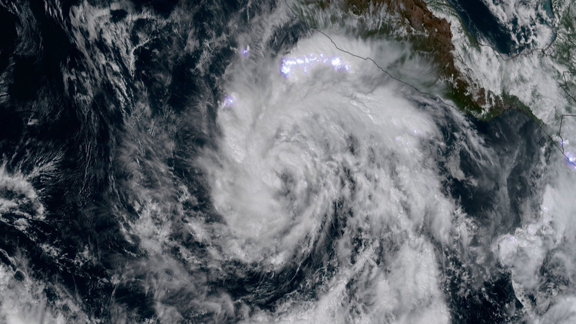
Menu
Home
Events
Archive
Daily
info
x
Select individual locations or phenomena you wish to receive notifications about. Or select the All checkbox to be notified about all events.
Norma was a major hurricane in the Eastern Pacific basin.
Norma made landfall as a category 1 storm along the southern tip of Baja California Sur near Cabo San Lucas.
For more information, see the National Hurricane Center.
Visit event location on SLIDER
Hover over the boxes to play. Click the images to view enlarged
Description:
Hurricane Norma made landfall on the southern tip of the Baja California peninsula, then made a second landfall as a tropical depression in the state of Sinaloa a couple days later.
Phenomena: Tropical Cyclones Hurricanes
Satellite: GOES-18
Product: GeoColor GLM Group Energy Density
Instrument: ABI GLM
Norma’s intensification seen by polar orbiting satellites.
Satellite: NOAA-20 NOAA-21 S-NPP
Product: Infrared (band I5)
Instrument: VIIRS
This multi-day time lapse shows the evolution of Norma, rapidly intensifying from a tropical storm into a category four hurricane.
Product: Infrared (band 13)
Instrument: ABI
Norma strengthens to a major category 4 storm.
Product: Infrared (band 13) Visible (band 2)
The sun sets on a strengthening Hurricane Norma.
Product: Visible (band 2)
Tropical Storm Norma continues to strengthen well offshore of southwestern Mexico. The storm is expected to become a hurricane soon.
Phenomena: Tropical Cyclones
Newly formed Tropical Storm Norma is spinning off the southwestern shore of Mexico. The storm is expected to strengthen in the coming days.