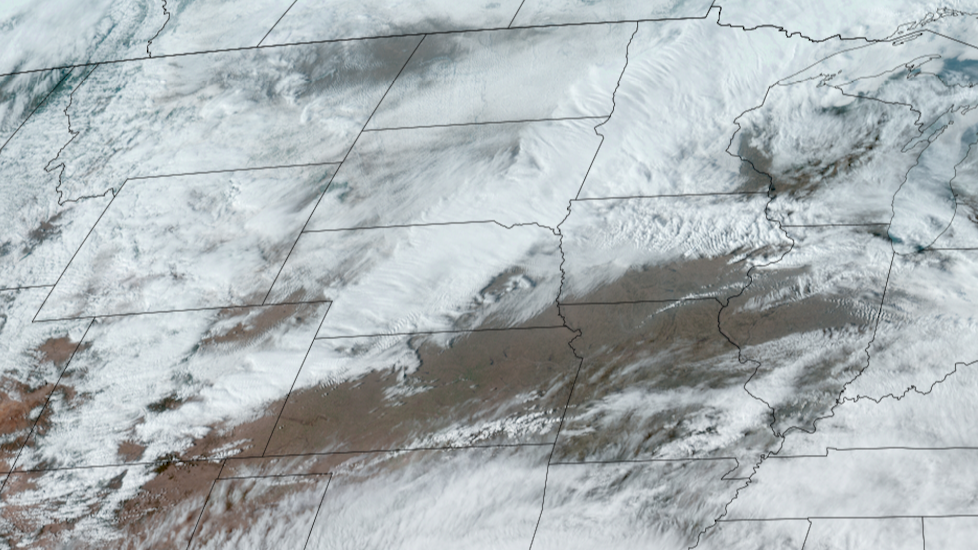
Late February Storm System

A cold front swept across the Central US, impacting everything from winter weather, to fire weather, to severe weather.

Snow squall warnings were issued from the Rockies to the Central/Northern Plains as heavy snow and strong winds proliferated from the front.

Blizzard warnings in the far Northern Plains also were issued due to the winter weather induced by the front.

The frontal system’s strong winds also created the conditions necessary to warrant red flag warnings across the Southern Plains and parts of the Midwest.

This especially posed a threat to the (at the time) ongoing fires in Oklahoma and the Texas Panhandle as the passing front ended up directing the direction and danger of the wildfires.

During the evening and overnight hours, severe weather fired-up along the front, with the main threats including large hail and tornadoes. The Midwest then became the main area of concern, including Chicago and areas along Lake Michigan, as well as the Ohio River Valley under risk of severe thunderstorms.

|
Contributions by: Josh Reiter, Kim Erickson and Dakota Smith

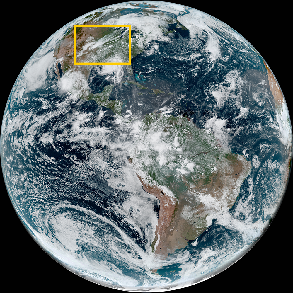
Satellite imagery of this event:

Hover over the boxes to play. Click the images to view enlarged

Lake Effect Snow for Great Lakes Region

Description:

Cold air streaming over the nearly ice-free Great Lakes brings lake effect snow to parts of New York, Southern Ontario and the Upper Peninsula of Michigan.


Phenomena: Winter Weather Lake Effect

Satellite: GOES-16

Product: GeoColor

Instrument: ABI

Storms and Severe Weather Trudge Across the Eastern US

Description:

A line of storms extending across the country traverse the Eastern US. Thunderstorms and severe weather propagate with this system.


Phenomena: Cold Fronts Lightning Thunderstorms Wind

Satellite: GOES-16

Product: GLM Group Energy Density Visible (band 2)

Instrument: ABI

Severe Weather and Thunderstorms Sweep Through the Midwest and Ohio Valley

Description:

Severe weather and thunderstorms sweep through the Midwest and Ohio Valley. Storms are expected to continue moving east throughout the day.


Phenomena: Cold Fronts Thunderstorms

Satellite: GOES-16

Product: GeoColor GLM Group Energy Density

Instrument: ABI GLM

Severe Storms Blast Through Chicago

Description:

Storms producing severe hail, wind, and tornadoes blast across northern Illinois into the Chicago metro region.


Phenomena: Thunderstorms Hail Tornadoes Wind

Satellite: GOES-16

Product: GeoColor GLM Group Energy Density

Instrument: ABI GLM

Cold Front Blitzes Toward Burning Wildfires

Description:

A cold front advancing south through Colorado and Kansas charges toward wildfires burning in Oklahoma and the Texas Panhandle.
 
This imagery showcases how different products can visualize both the frontal system and the fires.


Phenomena: Cold Fronts Wildfires Smoke

Satellite: GOES-16

Product: GeoColor Shortwave Window (Band 7)

Instrument: ABI

High Resolution View of Cold Front Captured by GOES-18

Description:

A high resolution view of the cold front moving through Colorado, Nebraska, and Kansas was captured by GOES-18.


Phenomena: Cold Fronts Winter Weather

Satellite: GOES-18

Product: Day Land Cloud

Instrument: ABI

Cold Front Heralds in Winter Weather and Thundersnow to the Plains and Rockies

Description:

A cold front continues to bulldoze through the Rockies and Central/Northern Plains today, heralding in winter weather along its path.


Phenomena: Winter Weather Snow Squall Thundersnow

Satellite: GOES-16

Product: GeoColor GLM Group Energy Density

Instrument: ABI