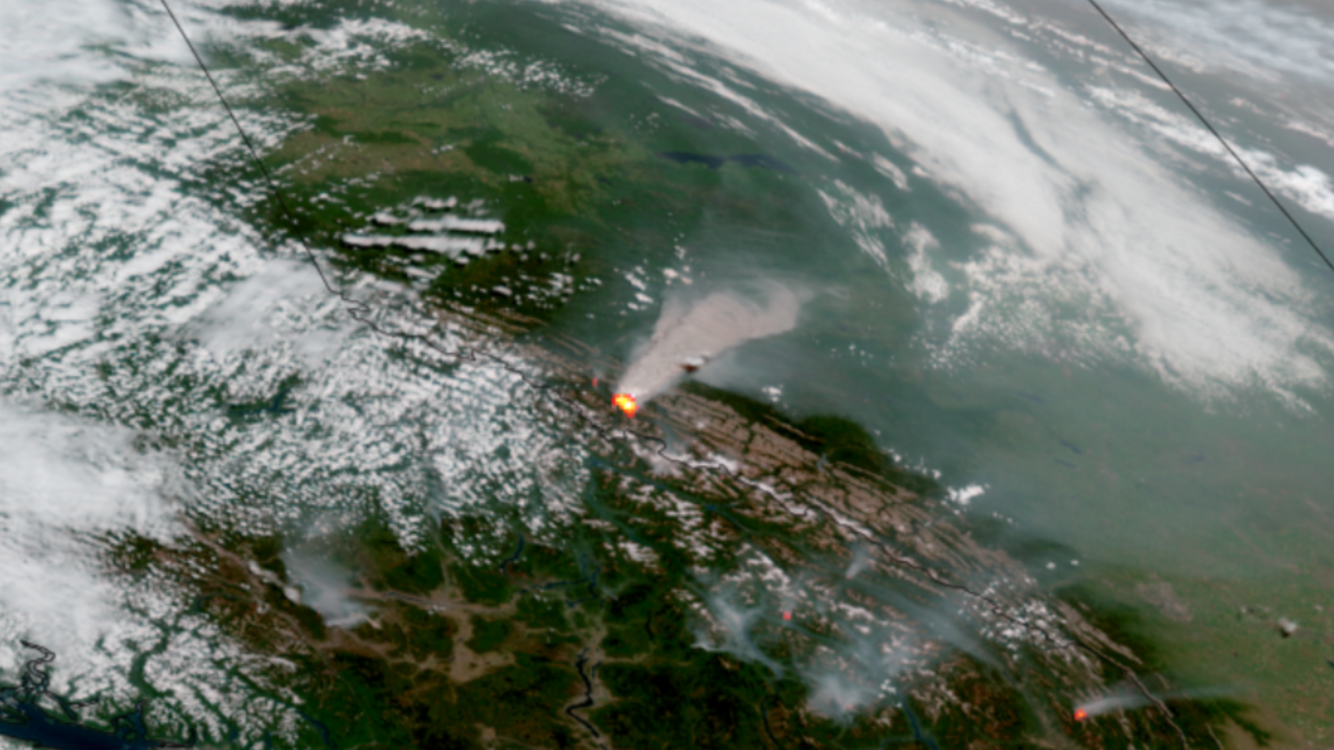
Western Canada Wildfires

The 2023/2024 winter season was the warmest on record for Canada and continuing drought conditions led to an early start of the wildfire season for the western part of the country.

The first major fire started on May 10th, 2024 near the remote town of Fort Nelson in British Columbia. Dry and windy conditions quickly spread the fire to over 13,050 acres in just three days.

On July 22nd, a fire started near the Jasper National Park, which prompted evacuations of the park and the nearby town of Jasper.

|
Contributions by: Josh Reiter, Kim Erickson and Dakota Smith

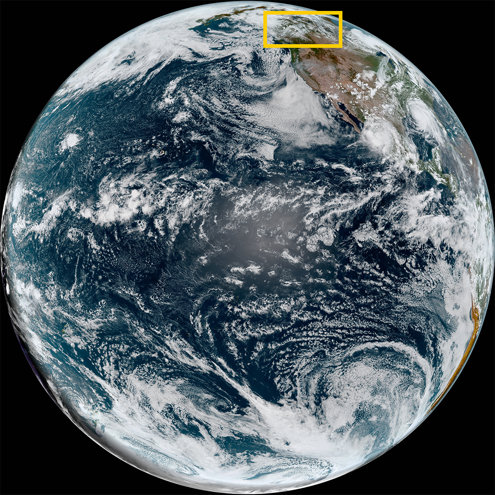
Satellite imagery of this event:

Hover over the boxes to play. Click the images to view enlarged

Smoke Threads Its Way Over Eastern North America

Description:

Smoke from distant wildfires threads its way above eastern North America.


Phenomena: Wildfires Smoke

Satellite: GOES-16

Product: GeoColor

Instrument: ABI

Astonishing View of Abundant Fire and Smoke in Western Canada

Description:

Dozens of wildfires ablaze across Western Canada fill the skies with smoke.


Phenomena: Wildfires Pyrocumulus Smoke

Satellite: GOES-18

Product: Fire Temperature GeoColor

Instrument: ABI

Hotspots and Smoke in Southwest Canada

Description:

Hotspots populate parts of Southwest Canada and the Pacific Northwest, as seen in this imagery taken last week from NOAA-20 and NOAA-21. This animation features the prominent wildfire and billowing smoke located near Jasper National Park in Alberta.


Phenomena: Wildfires Smoke

Satellite: NOAA-20 NOAA-21

Product: Day Fire

Instrument: VIIRS

High Resolution View of Wildfires Raging in the Pacific Northwest

Description:

A high resolution view shows wildfires raging across the Pacific Northwest.


Phenomena: Wildfires Pyrocumulus Smoke

Satellite: GOES-18

Product: Fire Temperature GeoColor

Instrument: ABI

Numerous Wildfires Rage Across Western Canada

Description:

Numerous large wildfires rage across Canada filling North American skies with smoke.


Phenomena: Wildfires Pyrocumulus Smoke

Satellite: GOES-18

Product: Fire Temperature GeoColor

Instrument: ABI

Wildfire Near Jasper National Park in Alberta

Description:

A large wildfire near Jasper National Park in Alberta, Canada has prompted evacuations of the park and the nearby town of Jasper.


Phenomena: Wildfires Smoke

Satellite: GOES-18

Product: GeoFire

Instrument: ABI

More Wildfires Burn Across Western Canada

Description:

More wildfires have started across western Canada.


Phenomena: Wildfires Smoke

Satellite: GOES-18

Product: GeoFire

Instrument: ABI

Smoke Wrapped Low Over Eastern Canada

Description:

A smoke wrapped low dominates the skies over eastern Canada.


Phenomena: Wildfires Smoke

Satellite: GOES-16

Product: GeoColor

Instrument: ABI

Wildfires Fill the Sky with Smoke Over Canada

Description:

GOES-18 keeps a watchful eye on the wildfire hotspots and smoke plumes across Canada.


Phenomena: Wildfires Smoke

Satellite: GOES-18

Product: GeoFire

Instrument: ABI

Smoke Migrates Across Canada and Down to the US

Description:

Smoke from the Canadian wildfires obscures the skies above North America, drifting further east across Canada and down into the northern United States.


Phenomena: Wildfires Smoke

Satellite: GOES-16

Product: GeoColor

Instrument: ABI

Wildfires and Thunderstorms for Central Canada

Description:

Wildfires burn across Central Canada as thunderstorms erupt in the summer heat.


Phenomena: Thunderstorms Wildfires Smoke

Satellite: GOES-18

Product: GeoFire Visible (band 2)

Instrument: ABI

Massive Fires and Smoke Filled Skies for Western Canada

Description:

Massive wildfires in western Canada continue to burn and fill the sky with smoke.


Phenomena: Wildfires Pyrocumulus Smoke

Satellite: GOES-18

Product: GeoFire

Instrument: ABI

Smoke Blankets Northern British Columbia and Alberta

Description:

Large wildfires burn in northeastern British Columbia, smothering the region in smoke.


Phenomena: Wildfires Smoke

Satellite: GOES-18

Product: GeoFire

Instrument: ABI

Multi-Day Timelapse of Fires and Smoke in Alaska

Description:

A zoomed-out multi-day view of the wildfires and smoke across the state of Alaska.


Phenomena: Wildfires Smoke

Satellite: NOAA-20 NOAA-21 S-NPP

Product: Fire Temperature GeoColor

Instrument: VIIRS

Many Fires Burn Across Northern British Columbia and Alberta

Description:

Many wildfires burn across the northern portions of British Columbia and Alberta.


Phenomena: Wildfires Smoke

Satellite: GOES-18

Product: GeoFire

Instrument: ABI

McDonald and Clear Fires Merge Southeast of Fairbanks

Description:

The McDonald and Clear fires have merged southeast of Fairbanks, Alaska. The wildfire is now over 107,391 acres.


Phenomena: Wildfires

Satellite: NOAA-20 NOAA-21 S-NPP

Product: Day Fire

Instrument: VIIRS

McDonald Fire Near Fairbanks Continues to Burn

Description:

The McDonald fire and others continue to burn near Fairbanks, Alaska.


Phenomena: Wildfires Smoke

Satellite: NOAA-20 NOAA-21 S-NPP

Product: Fire Temperature GeoColor

Instrument: VIIRS

Multiple Fires Burn Across Alaska

Description:

Multiple fires burn across Alaska, including the McDonald fire southeast of Fairbanks.


Phenomena: Wildfires Smoke

Satellite: NOAA-20 NOAA-21 S-NPP

Product: Fire Temperature GeoColor

Instrument: VIIRS

Wildfires Emerge in Alaska and Western Yukon

Description:

Polar-orbiting satellites utilizing their onboard VIIRS instrument captured active fires in Alaska and western Yukon.
 
The McDonald Fire south of Fairbanks, Alaska has seen very rapid growth in the last couple of days, increasing to about 24,000 acres in size.


Phenomena: Wildfires Smoke

Satellite: NOAA-20 NOAA-21 S-NPP

Product: Fire Temperature GeoColor

Instrument: VIIRS

See more Fires events: