Menu
Home
Events
Archive
Daily
info
x
Several rounds of severe storms have brought dangerous wind, hail, and tornadoes from the Plains, across the Midwest, to the East Coast.
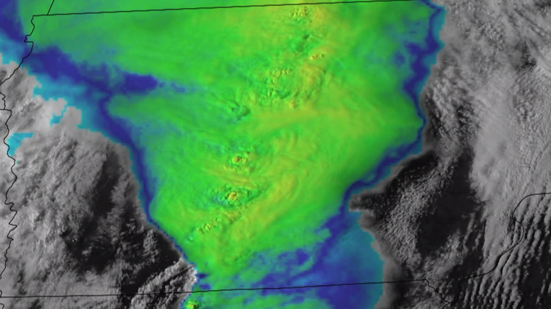
On May 21, 2024, a destructive line of storms brought several intense tornadoes to Iowa. Greenfield, IA took a direct hit where dozens of structures were destroyed and multiple fatalities were reported.
Detailed severe storm forecasts and reports can be found via the Storm Prediction Center.
Visit event location on SLIDER
Hover over the boxes to play. Click the images to view enlarged
Description:
An impressive supercell thunderstorm erupts near Midland, Texas.
Phenomena: Thunderstorms
Satellite: GOES-16
Product: Visible (band 2)
Instrument: ABI
As severe storms producing large hail and strong winds bulldoze through Texas, an outflow boundary races southwest, colliding with a dryline east of the Rockies where thunderstorms fire up. This imagery was captured in high-resolution yesterday by polar-orbiting satellites.
Satellite: NOAA-20 NOAA-21
Product: Day Cloud Phase Distinction
Instrument: VIIRS
Thunderstorms form a line that stretches from central Canada to central Mexico. Some of these storms produced large hail and a few tornados.
Product: GeoColor GLM Group Energy Density
Instrument: ABI GLM
Last night, a severe thunderstorm in the Big Bend region of Texas rained hail on the town of Marathon. The hail measured several inches deep in some places, and blanketed enough of the ground to be seen from satellite once the storm moved east.
Phenomena: Thunderstorms Hail
Product: Nighttime Microphysics
A line of thunderstorms moved across the North American High Plains overnight.
Thunderstorms begin to pop up over the High Plains of the US.
Product: Infrared (band 13) Visible (band 2)
Just following the end of the holiday weekend, many across the southern plains are waking up to severe thunderstorms producing damaging wind gusts and large hail this morning. Severe storms will threaten many of the same locations, including much of the state of Texas, later this afternoon and evening.
Phenomena: Thunderstorms Wind
Product: GeoColor Infrared (band 13)
A line of severe storms charges across the Midwest.
Phenomena: Lightning Thunderstorms Hail Tornadoes Wind
A damaging tornado rips across western Kentucky.
Phenomena: Lightning Thunderstorms Tornadoes
Severe thunderstorms and supercells ripped through the Mississippi and Ohio river valleys yesterday and last night, producing several tornadoes, large to very large hail, and damaging wind gusts across multiple states.
Phenomena: Lightning Thunderstorms
A powerful supercell produces a damaging tornado in North Texas.
Phenomena: Thunderstorms Tornadoes
Product: Infrared (band 13)
Lightning can be seen within a tornadic supercell in northern Texas.
A cluster of severe storms take off across Oklahoma and Texas.
Phenomena: Thunderstorms Above Anvil Cirrus Plumes Overshooting Tops
Round after round of severe weather moves through the eastern half of the US over Memorial Day Weekend.
A mesoscale convective system moved from the Central Plains into the Midwest overnight.
In the southern plains, severe thunderstorms fire up along a dryline situated in west Texas and western Oklahoma. Several tornado warnings have already been issued from these storms.
Product: GLM Group Energy Density Visible (band 2)
Multiple rounds of thunderstorms move across the US South.
Phenomena: Lightning Thunderstorms Above Anvil Cirrus Plumes
Severe weather erupted across the southern US this afternoon and evening, producing large hail and a couple tornadoes in west and central Texas.
Phenomena: Thunderstorms Overshooting Tops
Product: Day Land Cloud
Strong and severe thunderstorms darken the skies above the southern plains, with frequent lightning providing instances of illumination. Large hail and a few tornadoes were reported across portions of Texas.
Severe storms move through eastern Oklahoma and northeastern Texas.
As the sun rises on Oklahoma, severe thunderstorms cross the state.
The line of thunderstorms that produced tornadoes in Iowa continued to generate gusty, damaging winds as they moved into Wisconsin and Illinois during the evening hours,
Intense supercells are trampling across the state of Iowa this afternoon. Destructive and life-threatening tornadoes have been, and continue to be, produced from these storms.
Polar-orbiting satellites were in good position to capture the thunderstorms and supercells that afflicted the Midwest and southern plains over the last couple of days.
Satellite: NOAA-20 NOAA-21 S-NPP
Product: Infrared (band I5) Visible (I1)
A powerful line of storms racing across the Midwest produce destructive tornadoes in Iowa.
Severe thunderstorms initiate over eastern Nebraska and move over Iowa.
See more Severe Storms events:
Flooding Rain for Southern Florida -