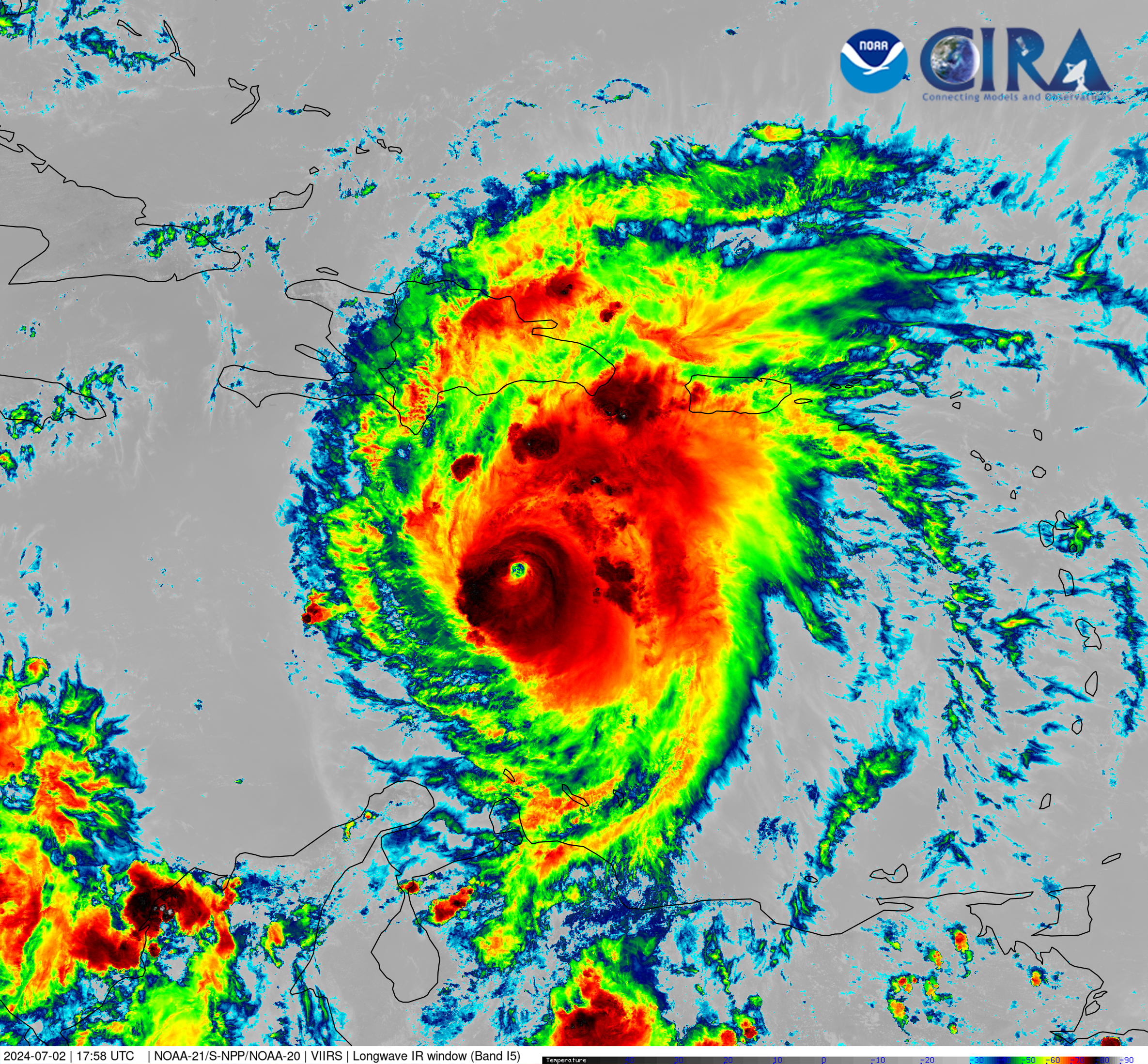
Hurricane Beryl in the Caribbean Sea as Seen From JPSS
Satellite imagery of this event:
Hover over the boxes to play. Click the images to view enlarged
How to credit this imagery | Contributions by: CIRA Staff

Media Details
NOAA-21 was able to capture Hurricane Beryl in high-resolution this afternoon as it traverses the Caribbean Sea, south of Hispaniola. The deeper colors in this imagery indicate the cold cloud tops, highlighting the strength of the storm.
Satellites NOAA-21
Products Infrared (band I5)
Instruments VIIRS
Timespan Start: 2024/07/02 17:58 - 2024/07/02 17:58

