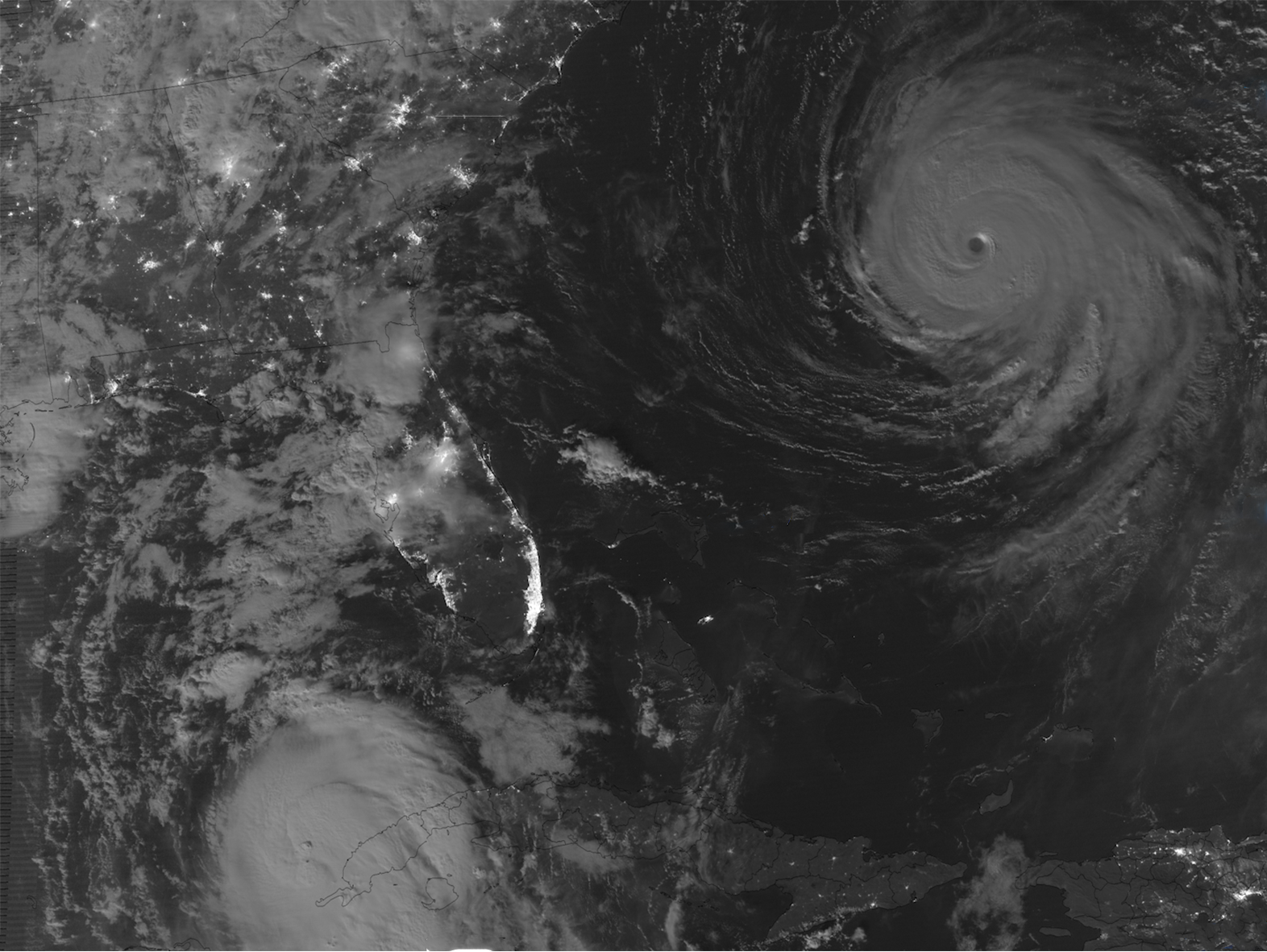
Hurricane Franklin

Hurricane Franklin

Franklin is a hurricane in the North Atlantic Ocean.

For detailed information and forecasts, visit the National Hurricane Center.

|
Contributions by: Kim Erickson

Satellite imagery of this event:

Hover over the boxes to play. Click the images to view enlarged

Franklin Still Churning as a Category 2 Storm

Description:

Hurricane Franklin is still churning in the Atlantic at category 2 strength. Bermuda is under a Tropical Storm warning and life threatening surf and rip currents are happening along the East coast of the United States due to Franklin.


Satellite: GOES-16

Product: GeoColor

Moon Shines Some Light Down On Franklin and Idalia

Description:

The nearly-full moon showcases two hurricanes at night using stitched-together high-resolution imagery from polar-orbiting satellites.


Satellite: S-NPP

Product: Day/Night Band

Franklin Still a Major Hurricane While Meandering North

Description:

Franklin maintains major hurricane strength as it meanders northward. The storm is offshore, but life-threatening surf and rip currents are occurring along the east coast of the United States, and are expected to continue for several days.


Satellite: GOES-16

Product: GeoColor

Detailed View of Hurricane Franklin's Eye

Description:

A high resolution image of Franklin’s clear eye was captured by NOAA-20.


Satellite: NOAA-20

Product: Visible (I1)

Instrument: VIIRS

Franklin Maintains Category 4 Strength

Description:

Hurricane Franklin reached Category 4 strength and maintained it throughout the day.


Satellite: GOES-16

Product: Visible (band 2)

Sun Rises On a Category 4 Hurricane Franklin

Description:

A very impressive eye at the center of a strong Hurricane Franklin. Franklin produced large ocean swells, leading to dangerous rip-currents and surf along the US east coast.


Satellite: GOES-16

Product: Visible (band 2)

Evolution of Hurricane Franklin During the Day & Night

Description:

Utilizing a favorable moon position, Franklin can be seen both during the day and at night from polar-orbiting satellites.


Satellite: NOAA-20 NOAA-21 S-NPP

Product: Day/Night Band

Detailed View of Franklin's Convection

Description:

A detailed view of Franklin’s convection in infrared was caught by polar orbiting satellites.


Satellite: NOAA-20 NOAA-21 S-NPP

Product: Infrared (band I5)

Tropical Storm Franklin Moves Northward and Offshore

Description:

Franklin brought tropical storm conditions overnight to the Dominican Republic and the Turks and Caicos Islands. Franklin has now moved offshore to the north.


Satellite: GOES-16

Product: GeoColor

Tropical Storm Franklin Making Landfall in Barahona, Dominican Republic

Description:

Tropical Storm Franklin Making Landfall in Barahona, Dominican Republic, bringing heavy rains.


Satellite: GOES-16

Product: GeoColor

Tropical Storm Franklin Organizing While Drifting Northward

Description:

Tropical Storm Franklin is starting to show some organization.


Low level circulation is becoming more well defined as the storm drifts northward toward Hispaniola.


Satellite: GOES-16

Product: ProxyVis

The Sun Rises On Franklin In the Caribbean Sea

Description:

Franklin attempts to gather more defined circulation as post-tropical storm Gert falls apart to the east of the Lesser Antilles.


Satellite: GOES-16

Product: GeoColor GLM Group Energy Density

Cloud Tops Bubble-Up Within Franklin

Description:

Convection during the morning hours leads to bursting cold clouds over-top of Tropical Storm Franklin.


Satellite: GOES-16

Product: Infrared (band 13) Visible (band 2)

- August 21, 2023

See more Tropical Cyclones events: