
Hurricane Debby In-Depth
Satellite imagery of this event:
Hover over the boxes to play. Click the images to view enlarged
Media Details
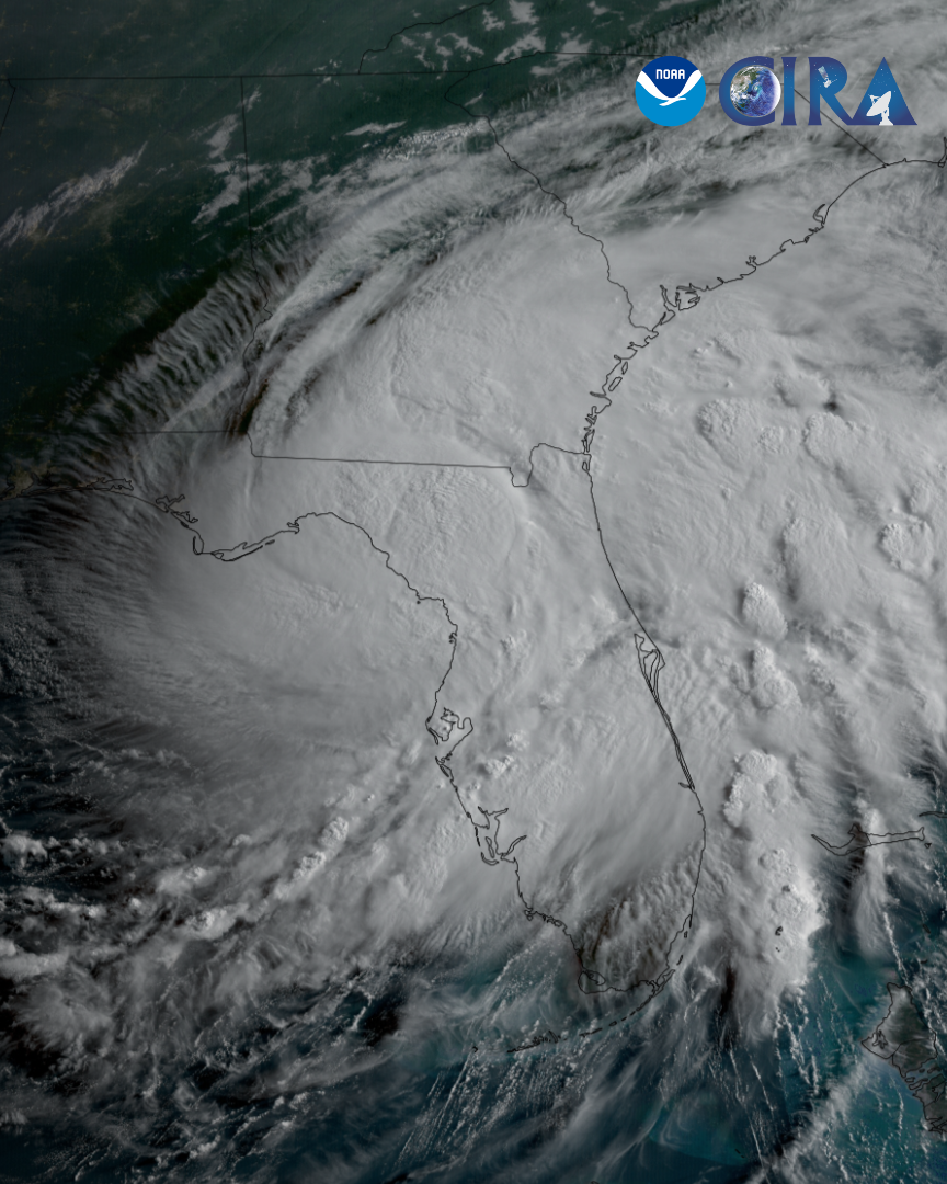
On August 5th, 2024, Hurricane Debby made landfall as a category one storm along Florida’s Big Bend region. (Image 1) Prior to landfall, Debby was fueled by the very warm waters of the Gulf of Mexico- surface temperatures averaged nearly 90°F (31°C) on August 1, 2024. (Image 2) This allowed the storm to dump at least six inches (38 cm) of rain over much of Florida, with some areas receiving over 15 inches (38 cm), leading to widespread flooding across the state.
As Debby moved over northern Florida towards Georgia, the polar-orbiting satellite, S-NPP, snapped a high-resolution view of the storm in long-wave infrared light. The darker orange and reddish colors indicate the coldest cloud tops, which tell scientists where the strongest parts of the storm are located. (Image 3)
After crossing Georgia, the storm spent a day over the Atlantic Ocean before turning northward and making landfall a second time on South Carolina’s central coast. Tropical Storm Debby brought nearly a foot (30 cm) of rain to much of South Carolina and southern North Carolina. Lightning energy density is overlayed on the GeoColor product, highlighting thunderstorm activity within the system. (Image 4)
Timespan Start: 2024/08/01 15:41 - 2024/08/07 22:40