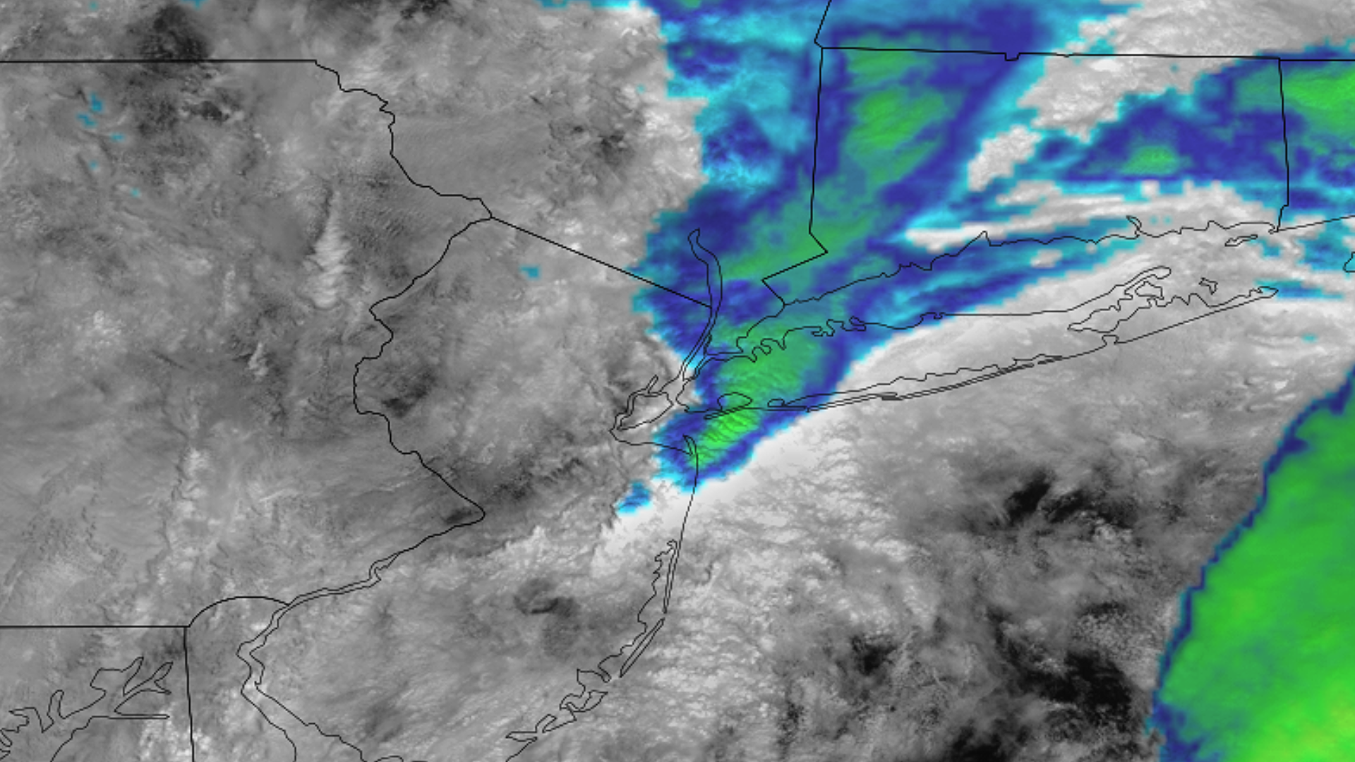
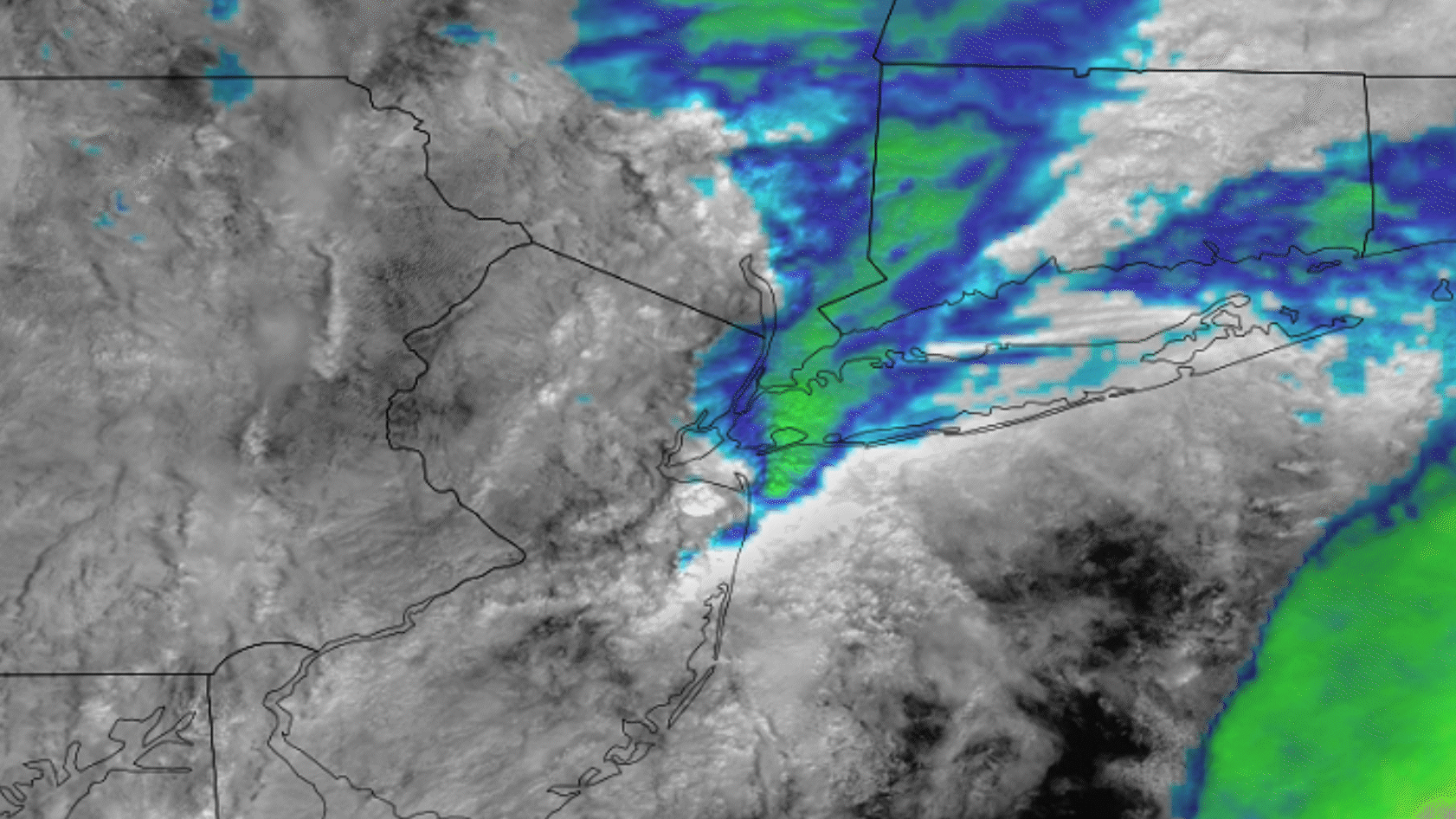
Menu
Home
Events
Archive
Daily
info
x
Showers and storms brought torrential rains and flash floods to the New York City metro region. A severe storm on Sept. 29 pounded 7 inches of rain on the city in 24 hours.
Rainfall was reported at 2.5 inches per hour as the storm slammed the metropolitan region’s aging architecture. The storm placed 23 million people across New York, Connecticut and New Jersey under a flash flood watch on Sept. 29.
The storm shuttered the subway system and grounded planes at the regional airports, and a school in Brooklyn was evacuated due to the floods.
Visit event location on SLIDER
Hover over the boxes to play. Click the images to view enlarged
Description:
Dangerous flooding results from the heavy rains that fell across New York City and the surrounding areas.
Satellite: NOAA-20 NOAA-21 S-NPP
Product: Infrared (band m15)
Instrument: VIIRS
The darker gray clouds indicate higher ice concentrations, meaning those clouds are taller to reach colder temperatures, thus they hold more precipitation.
Product: Snow/Ice (m10)
A constant barrage of storms funneling off the Atlantic brought dangerous flash floods to the New York City metro.
Satellite: GOES-16
Product: Infrared (band 13) Visible (band 2)
Training showers and storms bring dangerous floods to New York City.
Product: Visible (band 2)
Rain continued across the New York City area through the afternoon.
Phenomena: Flooding
Another perspective of the overwhelming precipitation that fell over New York City.
Product: Water Vapor (band 10)
Product: Ash (EUMETSAT)
A multi-day time lapse that shows the broader set up that lead to flash flooding in New York City.
Phenomena: Flooding Mid-latitude Cyclones
Product: Infrared (band 13)
See more Severe Storms events:
Tennessee Tornadoes -