Menu
Home
Events
Archive
Daily
info
x
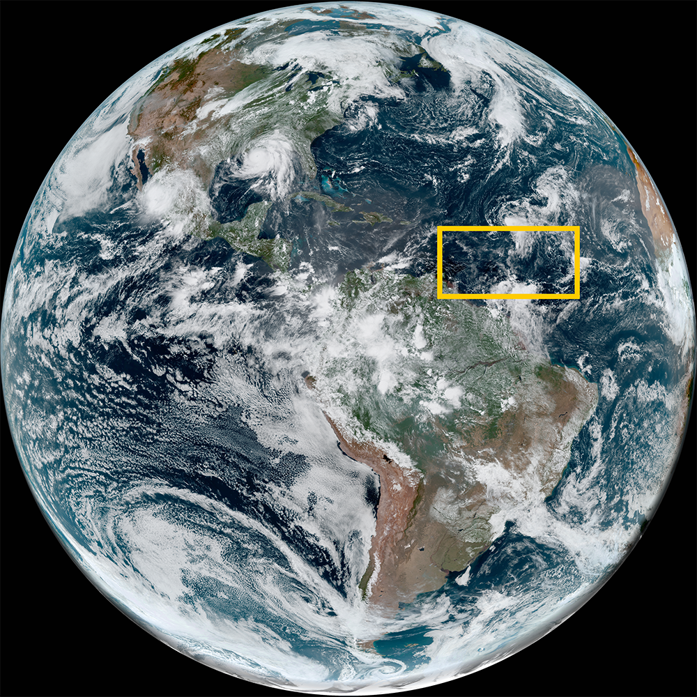
On June 28, 2024, Beryl formed as a tropical storm in the Atlantic Ocean. The next day, it was upgraded to a hurricane. Beryl joins rare company as most hurricanes that form this far east in the Atlantic occur later in the tropical season.
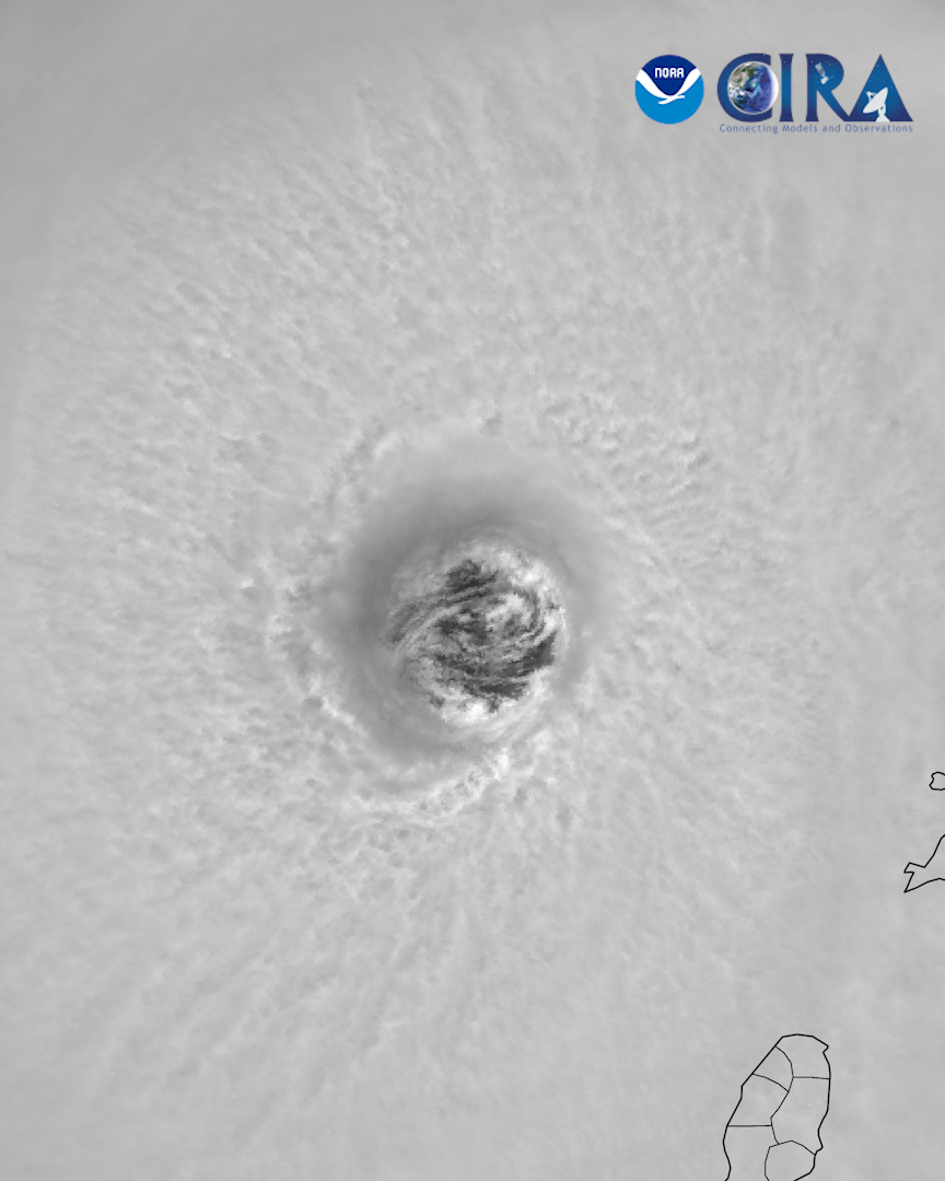
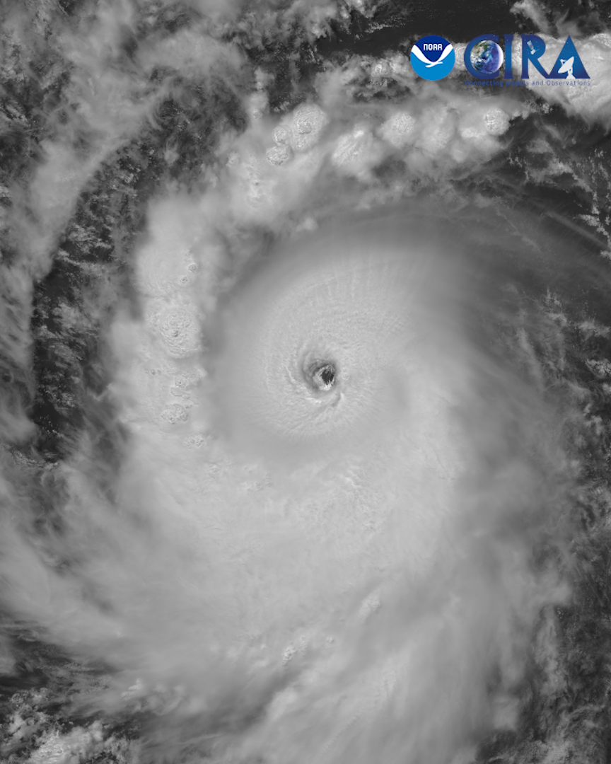
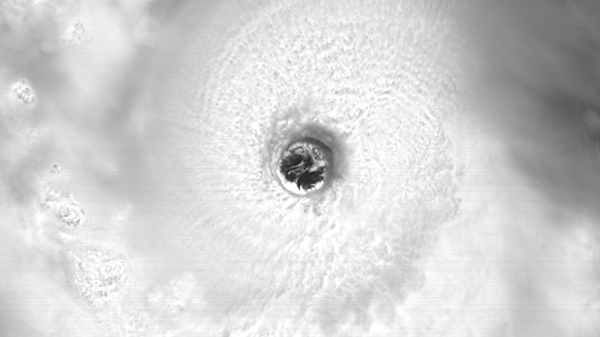
On June 30, 2024, Beryl became a major, category four hurricane. Beryl became the earliest category four storm to form in the Atlantic Basin, in recorded history. The next day, Hurricane Beryl made landfall on Carriacou Island with 150 mph winds.
That same day on July 1, 2024, shortly after making landfall and moving into the Caribbean Sea, Hurricane Beryl broke yet another record, becoming the earliest category five storm ever observed and only the second category five storm to occur in the month of July.
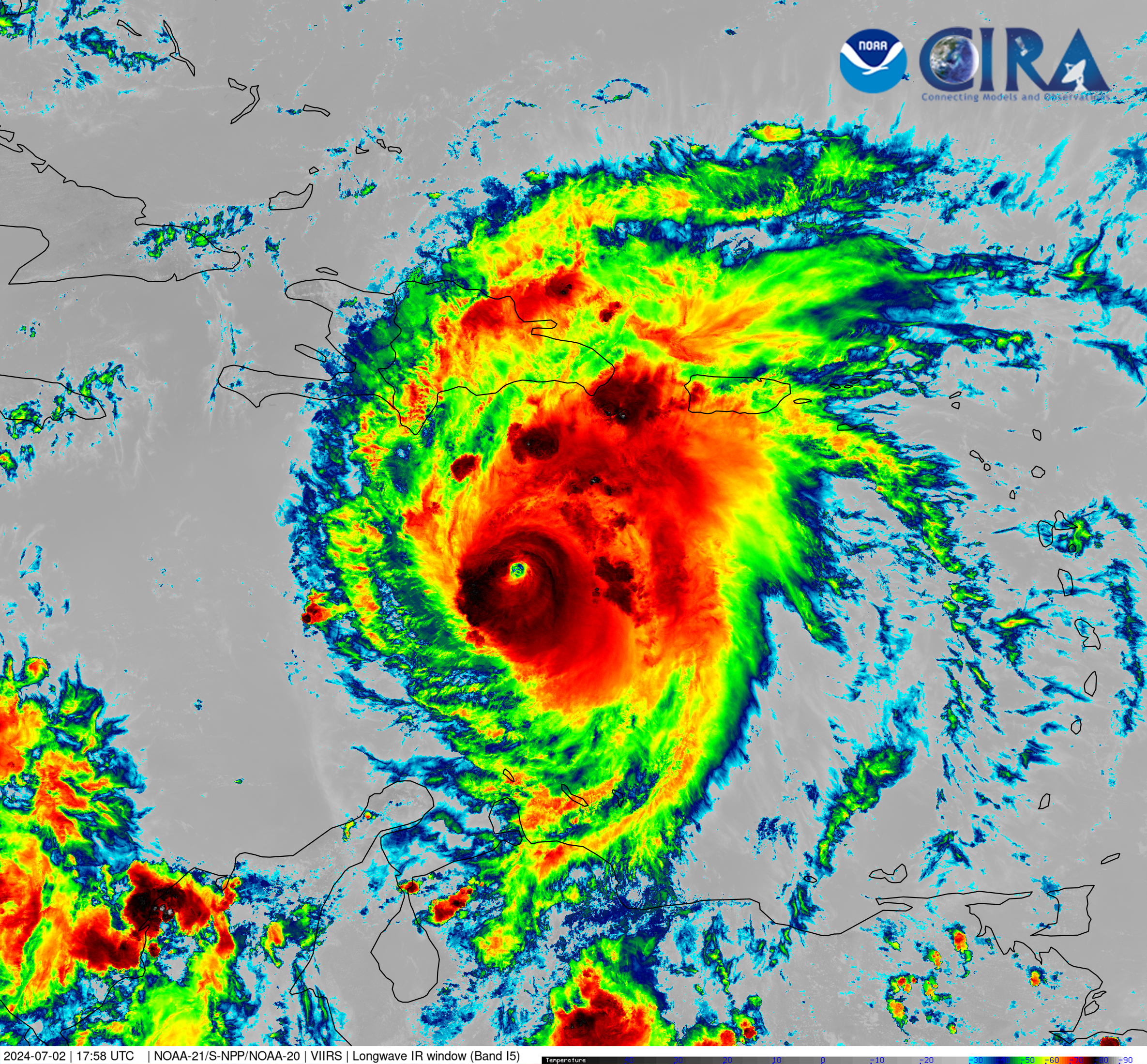
Hurricane Beryl is forecasted in the coming days to bring destructive forces to Jamaica and the Cayman Islands before arriving at the Yucatan Peninsula of Mexico.
For more information, visit the National Hurricane Center.
Visit event location on SLIDER
Hover over the boxes to play. Click the images to view enlarged
Description:
On July 1, NOAA-20 passed directly over Hurricane Beryl, getting a clear view of inside the eye of the storm.
Phenomena: Tropical Cyclones Hurricanes
Satellite: NOAA-20
Product: Visible (I1)
Instrument: VIIRS
The eyewall of Hurricane Beryl slams into the southern coast of Jamaica. Dangerous conditions, including hurricane-force winds and life-threatening storm surge, are expected to continue in Jamaica over the next few hours.
Phenomena: Lightning Tropical Cyclones Hurricanes
Satellite: GOES-16
Product: GLM Group Energy Density Visible (band 2)
Instrument: ABI GLM
Hurricane Beryl batters Jamaica with life-threatening storm surge, destructive winds, and heavy rainfall as the cyclone passes south of the island nation. Beryl is forecasted to bring similar tropical conditions to the Cayman Islands overnight.
Product: Infrared (band 13) Visible (band 2)
Instrument: ABI
Hurricane Beryl passes to the south of Haiti and the Dominican Republic as a category 4 storm.
Product: GeoColor GLM Group Energy Density
NOAA-21 was able to capture Hurricane Beryl in high-resolution this afternoon as it traverses the Caribbean Sea, south of Hispaniola. The deeper colors in this imagery indicate the cold cloud tops, highlighting the strength of the storm.
Satellite: NOAA-21
Product: Infrared (band I5)
The first four days of Beryl, from tropical cyclone in the western Atlantic Ocean to a category five hurricane in the Caribbean Sea.
Product: GeoColor
High-resolution infrared imagery of Beryl’s first few days as a hurricane, as seen from the VIIRS instrument aboard polar-orbiting satellites.
Satellite: NOAA-20 NOAA-21 S-NPP
The sun rises on a category 5 Hurricane Beryl this morning, continuing to maintain structure and intensity as it sails westward across the Caribbean Sea.
Product: GeoColor Visible (band 2)
Hurricane Beryl becomes a powerful, category 5 storm, the earliest such storm in recorded history. This view shows Beryl churning in the Caribbean Sea.
Sunlight fades on a powerful Hurricane Beryl as lightning flashes within.
Symmetry within Hurricane Beryl as the cyclone enters the Caribbean Sea.
Product: Infrared (band 13)
An extraordinary view of mesovortices swirling within Hurricane Beryl’s eye as it makes landfall on Carriacou Island with 150 mph winds.
Product: Visible (band 2)
Hurricane Beryl is a major category four storm as it nears the Windward Islands.
NOAA-21 captured a high-resolution view of Beryl as it approached the Windward Islands. Includes a wide view and a zoomed in view of the eye.
Phenomena: Tropical Cyclones
A stunning view of Hurricane Beryl’s clear, powerful eye.
A remarkable view of abundant lightning within Hurricane Beryl’s eye wall.
Hurricane Beryl continues to quickly strengthen as it approaches the Windward Islands. Currently a category 3 storm, Beryl is expected to be a major category 4 storm when it reaches the Islands within the next day.
Beryl has rapidly intensified into a hurricane, the first one of the 2024 Atlantic tropical season. Beryl is forecasted to evolve into a major hurricane prior to reaching the Windward Islands and the Caribbean Sea.
Phenomena: Tropical Cyclones Hurricanes Rapid Intensification
This time yesterday, Beryl was a tropical storm on the verge of being a hurricane. Now it is a category 4 hurricane, the earliest in recorded history. This imagery over the last day showcases Hurricane Beryl’s rapid intensification.
Tropical Storm Beryl forms in the Atlantic as convection bursts within.
Phenomena: Lightning Tropical Cyclones
Tropical Storm Beryl strengthens as it pushes west.
Tropical Depression Two has formed in the mid-Atlantic Ocean, and will continue to strengthen as it pushes westward towards the Lesser Antilles. The next storm name on the 2024 Atlantic tropical cyclone list is Beryl.
A tropical system continues to organize in the Atlantic.
A tropical wave slowly organizes in the tropical Atlantic.
See more Tropical Cyclones events:
Tropical Storm Chris -